<< YCBA Home Yale Center for British Art Yale Center for British Art << YCBA Home

YCBA Collections Search

Search Constraints

You searched for:

Work Type engraving

Remove constraint Work Type: engraving

Classification Maps & Atlas (printed)

Remove constraint Classification: Maps & Atlas (printed)

Search Results

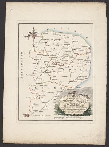
Boulton, George. The route of the mail & post coaches, George Boulton & Co. proprietors :
Boulton, George
The route of the mail & post coaches, George Boulton & Co. proprietors
[between 1796 and 1809]
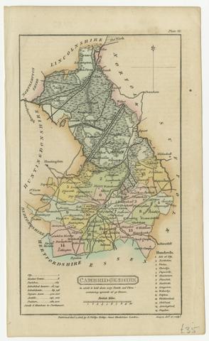
Capper, Benjamin Pitts, cartographer.  Cambridgeshire :
Capper, Benjamin Pitts
Cambridgeshire
[1808]
Saxton, Christopher, 1542?- [Atlas of the counties of England and Wales].
Saxton, Christopher, 1542?-
[Atlas of the counties of England and Wales]
[1590?]
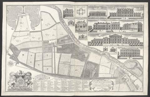
Rocque, John, -1762. Plan of the house, gardens, park & hermitage of Their Majesties at Richmond :
Rocque, John, -1762
Plan of the house, gardens, park & hermitage of Their Majesties at Richmond
1734
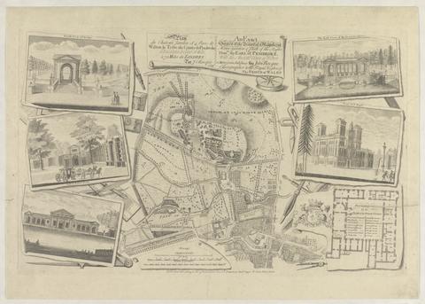
Rocque, John, -1762. Plan du chateau, jardin et parc de Wilton :
Rocque, John, -1762
Plan du chateau, jardin et parc de Wilton
1754
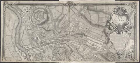
Rocque, John, -1762. A plan of the city of Bristol /
Rocque, John, -1762
A plan of the city of Bristol
1743
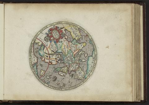
Kip, William, engraver. Academiarum totius Europae seu orbis Christiani iuxta suas provincias nova tabula ad usum studiosorum emendate accomodate
Kip, William
Academiarum totius Europae seu orbis Christiani iuxta suas provincias nova tabula ad usum studiosorum emendate accomodate
An 1602
Leslie, John, 1527-1596, cartographer. Scotiae Regni Antiqvissimi Accvrata Descriptio /
Leslie, John, 1527–1596
Scotiae Regni Antiqvissimi Accvrata Descriptio
MDLXXVIII [1578]
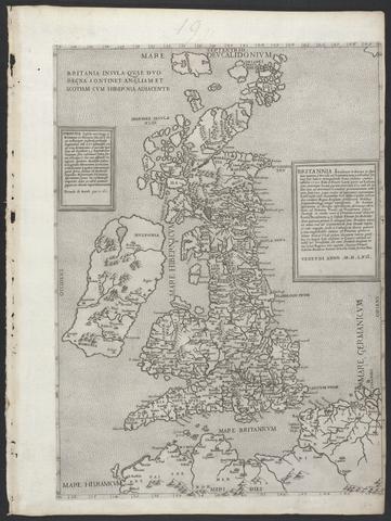
Lily, George, active 1528-1559. Britannia insula quae duo regna continet Angliam et Scotiam cum Hibernia adiacente.
Lily, George, active 1528–1559
Britannia insula quae duo regna continet Angliam et Scotiam cum Hibernia adiacente
MDLVI [1556]
Saxton, Christopher, 1542?- cartographer. [The travellers guide :
Saxton, Christopher, 1542?-
[The travellers guide
[1686?]
Allard, Hugo, approximately 1628-1691, cartographer. [Chart of the Thames estuary with a view of the English fleet burning in the Medway]
Allard, Hugo, approximately 1628–1691
[Chart of the Thames estuary with a view of the English fleet burning in the Medway]
1667
Overton, John, 1640-1708?  [Composite world atlas].
Overton, John, 1640–1708?
[Composite world atlas]
[1686?]
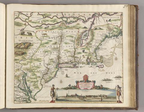
Visscher, Nicolaes, 1618-1679, cartographer. Novi Belgii Novaeque, Angliae nec non partis Virginiae tabula :
Visscher, Nicolaes, 1618–1679
Novi Belgii Novaeque, Angliae nec non partis Virginiae tabula
[ca. 1684]
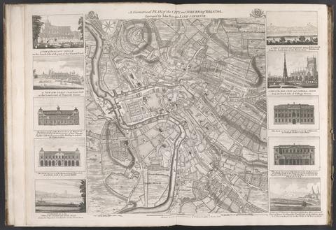
Rocque, John, -1762. A geometrical plan of the city and suburbs of Bristol /
Rocque, John, -1762
A geometrical plan of the city and suburbs of Bristol
[175-?]
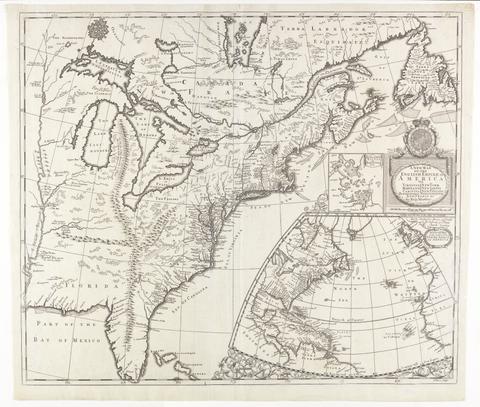
Morden, Robert, approximately 1650-1703, cartographer. A new map of the English empire in America :
Morden, Robert, approximately 1650–1703
A new map of the English empire in America
[ca. 1695]
Ogilby, John, 1600-1676. A large and accurate map of the city of London :
Ogilby, John, 1600–1676
A large and accurate map of the city of London
1677]
 To Martin Folkes, esq., president of the Royal Society :
To Martin Folkes, esq., president of the Royal Society
1749
Great Britain. Ordnance Survey, cartographer, publisher. [Old series Ordnance Survey maps of England and Wales]
Great Britain. Ordnance Survey
[Old series Ordnance Survey maps of England and Wales]
1805-1834 [i.e. 1834-1835?]
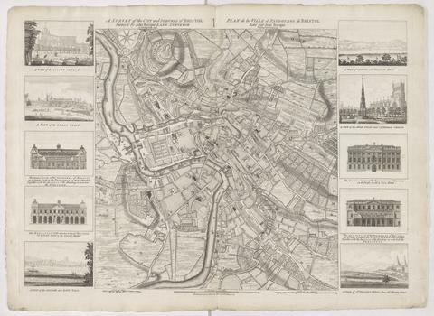
Rocque, John, -1762. A survey of the city and suburbs of Bristol /
Rocque, John, -1762
A survey of the city and suburbs of Bristol
1750
Kip, William, engraver. Galliae descriptio
Kip, William
Galliae descriptio
[ca. 1602]
C. & H. Greenwood. Map of the county of Monmouth :
C. & H. Greenwood
Map of the county of Monmouth
1831
Laurie, Richard Holmes. Survey of the country around London :
Laurie, Richard Holmes
Survey of the country around London
1852
Saxton, Christopher, 1542?- cartographer. Southamtoniae comitatus (preter insulas Vectis, Jersey et Garnsey quae sunt partes eius dem comitatus) cum suis undiq[ue] confinibus, oppidis, pagis, villis, et fluminibus vera descriptio /
Saxton, Christopher, 1542?-
Southamtoniae comitatus (preter insulas Vectis, Jersey et Garnsey quae sunt partes eius dem comitatus) cum suis undiq[ue] confinibus, oppidis, pagis, villis, et fluminibus vera descriptio
[1575]
Doornick, Marcus Williamsz. Platte grondt der Vebrande Stadt London /
Doornick, Marcus Williamsz
Platte grondt der Vebrande Stadt London
1666
Mercator, Gerhard, 1512-1594, cartographer. Gerardi Mercatoris Atlas, sive, Cosmographicae meditationes de fabrica mundi et fabricati figura /
Mercator, Gerhard, 1512–1594
Gerardi Mercatoris Atlas, sive, Cosmographicae meditationes de fabrica mundi et fabricati figura
anno 1632
Boazio, Baptista, cartographer. The true description or draffte of that famous Ile of Wighte :
Boazio, Baptista
The true description or draffte of that famous Ile of Wighte
1591
Matal, Jean, 1520-1597, author. Europa tabulis aeneis 166 secundum rationes geographicas delineata :
Matal, Jean, 1520–1597
Europa tabulis aeneis 166 secundum rationes geographicas delineata
anno domini MDC [1600]
Goos, Pieter, approximately 1616-1675. West-Indische paskaert :
Goos, Pieter, approximately 1616–1675
West-Indische paskaert
[approximately 1660]
Froggett, John, active 1808-1821, cartographer.  Froggett's survey of the country thirty miles round London, 1836
Froggett, John, active 1808–1821
Froggett's survey of the country thirty miles round London, 1836
[1836]
 Cambridge Shire /
Cambridge Shire
[1695?]
Speed, John, 1552?-1629. America with those known parts in that unknowne worlde both people and manner of buildings /
Speed, John, 1552?-1629
America with those known parts in that unknowne worlde both people and manner of buildings
[1662?]
Morden, Robert, approximately 1650-1703. A new mapp of England Scotland and Ireland
Morden, Robert, approximately 1650–1703
A new mapp of England Scotland and Ireland
[1678]
C. & J. Greenwood. Map of the county of Kent,
C. & J. Greenwood
Map of the county of Kent,
July 4th, 1829
Morden, Robert, approximately 1650-1703, cartographer. A new map of the English plantations in America
Morden, Robert, approximately 1650–1703
A new map of the English plantations in America
[ca. 1677]
Great Britain. Ordnance Survey. [Old series Ordnance Survey maps of England and Wales]
Great Britain. Ordnance Survey
[Old series Ordnance Survey maps of England and Wales]
[1839-1874?]
Wren, Christopher, Sir, 1632-1723. Ichnographia urbis Londinii :
Wren, Christopher, Sir, 1632–1723
Ichnographia urbis Londinii
1724
Morden, Robert, approximately 1650-1703. [The 52 countries [sic] of England and Wales
Morden, Robert, approximately 1650–1703
[The 52 countries [sic] of England and Wales
Valck, G. (Gerard), 1651-1726, cartographer. Magna Britannia, aut Anglia, Scotia et Hibernia, quarum prior divisa in septem Regna, sive Provincias, dictas Northumbriam, Merciam, Angliam Orient. Essexiam, Cantium, Sussexiam, Westsexiam, et Princi. Walliae. posterior in Septent. et Austr. Scotiam. postrema in quatuor Provincias Ultoniam, Lageniam, Momoniam, et Conagtiam /
Valck, G. (Gerard), 1651–1726
Magna Britannia, aut Anglia, Scotia et Hibernia, quarum prior divisa in septem Regna, sive Provincias, dictas Northumbriam, Merciam, Angliam Orient. Essexiam, Cantium, Sussexiam, Westsexiam, et Princi. Walliae. posterior in Septent. et Austr. Scotiam. postrema in quatuor Provincias Ultoniam, Lageniam, Momoniam, et Conagtiam
[approximately 1705]
Ortelius, Abraham, 1527-1598, cartographer. Maris Pacifici (quod vulg ̣Mar del Zur)
Ortelius, Abraham, 1527–1598
Maris Pacifici (quod vulg ̣Mar del Zur)
1589
Seller, John, active 1658-1698, compiler, publisher. Atlas Anglicanus et Cambria, or, A book of mapps of all the countyes in the kingdom of England and dominion of Wales /
Seller, John, active 1658–1698
Atlas Anglicanus et Cambria, or, A book of mapps of all the countyes in the kingdom of England and dominion of Wales
[1694?]
Ptolemy, active 2nd century, author, cartographer. Geographia Cl. Ptolemaei Alexandrini :
Ptolemy, active 2nd century
Geographia Cl. Ptolemaei Alexandrini
MDLXII [1562]
C. & J. Greenwood. Map of the county palatine of Durham,
C. & J. Greenwood
Map of the county palatine of Durham,
Jan. 26, 1831
Lily, George, active 1528-1559. Britania insula quae duo regna continet Angliam et Scotiam cum Hibernia adiacente /
Lily, George, active 1528–1559
Britania insula quae duo regna continet Angliam et Scotiam cum Hibernia adiacente
anno MDLXII [1562]
Rocque, John, -1762. A survey of the city and suburbs of Dublin :
Rocque, John, -1762
A survey of the city and suburbs of Dublin
1757
Perrot, A. M. (Aristide Michel), 1793-1879, cartographer. Carte pittoresque et maritime de la France
Perrot, A. M. (Aristide Michel), 1793–1879
Carte pittoresque et maritime de la France
1841
Speed, John, 1552?-1629, cartographer. A prospect of the most famous parts of the world ... :
Speed, John, 1552?-1629
A prospect of the most famous parts of the world ...
1627
Wit, Frederik de, 1629 or 1630-1706, cartographer, publisher. Atlas.
Wit, Frederik de, 1629 or 1630–1706
Atlas
[not before 1688]
Stanford, Edward, 1827-1904, cartographer. Stanford's library map of London and its suburbs
Stanford, Edward, 1827–1904
Stanford's library map of London and its suburbs
1862
Blaeu, Joan, 1596-1673. Le grand atlas, ou, Cosmographie Blauiane :
Blaeu, Joan, 1596–1673
Le grand atlas, ou, Cosmographie Blauiane
MDCLXVII [1667]
 The American military pocket atlas :
The American military pocket atlas
[1776]
Lewis, Samuel, -1865. An atlas, comprising maps of the several counties, divided into unions, and of the islands of Guernsey, Jersey, and Man :
Lewis, Samuel, -1865
An atlas, comprising maps of the several counties, divided into unions, and of the islands of Guernsey, Jersey, and Man
1842
Ordnance Survey (Ireland) Ordnance Survey of Ireland /
Ordnance Survey (Ireland)
Ordnance Survey of Ireland
[1858-1862]
Great Britain. Ordnance Survey. Ordnance survey of Scotland /
Great Britain. Ordnance Survey
Ordnance survey of Scotland
1856-1882
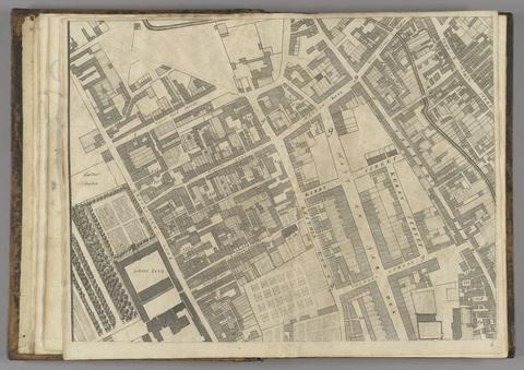
Rocque, John, -1762. A new and accurate survey of the cities of London and Westminster, the borough of Southwark :
Rocque, John, -1762
A new and accurate survey of the cities of London and Westminster, the borough of Southwark
1751
Gibson, J. (John), active 1750-1792, engraver. The road from London to Cambridge, Ely & Kings Lynn :
Gibson, J. (John), active 1750–1792
The road from London to Cambridge, Ely & Kings Lynn
[1769]
Collins, Greenvile, active 1669-1698, cartographer. Great Britain's coasting-pilot ... :
Collins, Greenvile, active 1669–1698
Great Britain's coasting-pilot ...
1693
Speed, John, 1552?-1629, cartographer. Theatrum Imperij Magnae Britanniae :
Speed, John, 1552?-1629
Theatrum Imperij Magnae Britanniae
anno cum privilegio 1616
Rocque, John, -1762. A map of the kingdom of Ireland :
Rocque, John, -1762
A map of the kingdom of Ireland
[between 1762 and 1773]
Ptolemy, active 2nd century. In hoc opere haec continentur Geographiae Cl. Ptolemaei a plurimis uiris utriusq[ue] linguae doctiss. eme[n]data, & cu[m] archetypo Graeco ab ipsis collata /
Ptolemy, active 2nd century
In hoc opere haec continentur Geographiae Cl. Ptolemaei a plurimis uiris utriusq[ue] linguae doctiss. eme[n]data, & cu[m] archetypo Graeco ab ipsis collata
anno Virginei partus 1508
Boazio, Baptista. S. Augustini pars est terrae Florida
Boazio, Baptista
S. Augustini pars est terrae Florida
[1588?]
Cary, John, approximately 1754-1835, cartographer, engraver, publisher  Cary's new universal atlas :
Cary, John, approximately 1754–1835
Cary's new universal atlas
1808
Peacock, W. (William), -1910, publisher. Scotland.
Peacock, W. (William), -1910
Scotland
[between 1901 and 1909?]
Ogilby, John, 1600-1676, cartographer. Britannia depicta, or, Ogilby improv'd :
Ogilby, John, 1600–1676
Britannia depicta, or, Ogilby improv'd
1749
Kitchin, Thomas, 1719-1784, cartographer. Cambridgeshire
Kitchin, Thomas, 1719–1784
Cambridgeshire
1747
Goos, Pieter, approximately 1616-1675.  De zee-atlas, ofte, water-weereld :
Goos, Pieter, approximately 1616–1675
De zee-atlas, ofte, water-weereld
1666
Visscher, Claes Jansz., 1586 or 1587-1652. Nova totius terrarum orbis geographica ac hydrographica tabula
Visscher, Claes Jansz., 1586 or 1587–1652
Nova totius terrarum orbis geographica ac hydrographica tabula
1652
Valck, G. (Gerard), 1651-1726, cartographer. Les isles Britanniques, qui contiennent les Royaumes d'Angleterre, Escosse, et Irlande :
Valck, G. (Gerard), 1651–1726
Les isles Britanniques, qui contiennent les Royaumes d'Angleterre, Escosse, et Irlande
[approximately 1695]
Evans, Lewis, 1700?-1756. A general map of the middle British colonies in America :
Evans, Lewis, 1700?-1756
A general map of the middle British colonies in America
1771
Rapkin, J. England and Wales /
Rapkin, J
England and Wales
[1851?]
Ogilby, John, 1600-1676. The road from Cambridge to Coventry
Ogilby, John, 1600–1676
The road from Cambridge to Coventry
[1720]
Evans, Lewis, 1700?-1756, cartographer. A map of Pensilvania, New-Jersey, New-York, and the three Delaware counties
Evans, Lewis, 1700?-1756
A map of Pensilvania, New-Jersey, New-York, and the three Delaware counties
1749
Keere, Pieter van den, 1571-approximately 1646, engraver. [Atlas of the British Isles]
Keere, Pieter van den, 1571–approximately 1646
[Atlas of the British Isles]
[Amsterdam?] :
Seutter, Matthäus, 1678-1757, engraver, publisher. Atlas geographicus, oder, Accurate Vorstellung der ganzen Welt in den nothwendigsten und von dem hochberühmten hamburgischen Rectore :
Seutter, Matthäus, 1678–1757
Atlas geographicus, oder, Accurate Vorstellung der ganzen Welt in den nothwendigsten und von dem hochberühmten hamburgischen Rectore
MDCCXX [1720]
Senex, John, -1740. A new map of the English empire in America
Senex, John, -1740
A new map of the English empire in America
1719
 Cambridgeshire.
Cambridgeshire
[1784]
Des Barres, Joseph F. W. (Joseph Frederick Wallet), 1729-1824.  The Atlantic Neptune
Des Barres, Joseph F. W. (Joseph Frederick Wallet), 1729–1824
The Atlantic Neptune
[1774-1800?]
Cary, John, approximately 1754-1835, engraver, publisher. A new map of Leicestershire
Cary, John, approximately 1754–1835
A new map of Leicestershire
Sepr. 28,1801
Moule, Thomas, 1784-1851, cartographer. Cambridgeshire.
Moule, Thomas, 1784–1851
Cambridgeshire
[1837]
Great Britain. Ordnance Survey, cartographer, publisher. [Old series Ordnance Survey maps of England and Wales] /
Great Britain. Ordnance Survey
[Old series Ordnance Survey maps of England and Wales]
Novr. 9th, 1843 [i.e. ca. 1853-1874?]
 Britannia prout divisa fuit temporibus Anglo-Saxonum praesertim durante illorum heptarchia
Britannia prout divisa fuit temporibus Anglo-Saxonum praesertim durante illorum heptarchia
[1645]
 Cambridgeshire.
Cambridgeshire
[1824?]
Mercator, Gerhard, 1512-1594, author. Historia mundi, or, Mercator's atlas :
Mercator, Gerhard, 1512–1594
Historia mundi, or, Mercator's atlas
1637
Bowen, Thomas, -1790, engraver. The roads from London to Norwich, Cambridge, Ely & Kings Lynn
Bowen, Thomas, -1790
The roads from London to Norwich, Cambridge, Ely & Kings Lynn
[1775?]
C. & J. Greenwood, cartographer, publisher. Atlas of the counties of England :
C. & J. Greenwood
Atlas of the counties of England
April 1st, 1834
Popple, Henry, -1743, cartographer. A map of the British Empire in America :
Popple, Henry, -1743
A map of the British Empire in America
[ca. 1737]
Morden, Robert, approximately 1650-1703, cartographer. England
Morden, Robert, approximately 1650–1703
England
[1695?]
Botero, Giovanni, 1540-1617, author. Mundus imperiorum, siue de mundi imperiis libri quatuor :
Botero, Giovanni, 1540–1617
Mundus imperiorum, siue de mundi imperiis libri quatuor
im Iahr MDCII [1602]
 Karta öfver segelleden från Stockholm kanalvägen till Götheborg :
Karta öfver segelleden från Stockholm kanalvägen till Götheborg
[1851?]
Cassini, César-François, 1714-1784, cartographer. A map of the kingdom of France :
Cassini, César-François, 1714–1784
A map of the kingdom of France
Augt. 2nd. 1838
Matal, Jean, 1520-1597, author. Africa ad artis geographicae regulas tabulis aeri incisis descripta /
Matal, Jean, 1520–1597
Africa ad artis geographicae regulas tabulis aeri incisis descripta
anno MDC [1600]
C. & J. Greenwood, cartographer. Map of the county of Cambridge :
C. & J. Greenwood
Map of the county of Cambridge
1834
Matal, Jean, 1520-1597, author. America, sive novus orbis, tabulis Aeneis secundum rationes geographicas delineatus /
Matal, Jean, 1520–1597
America, sive novus orbis, tabulis Aeneis secundum rationes geographicas delineatus
anno à partu Virgineo MDC [1600]
Rocque, John, -1762, cartographer.  A general map of North America :
Rocque, John, -1762
A general map of North America
[1762?]
Saxton, Christopher, 1542?- [Atlas of the counties of England and Wales].
Saxton, Christopher, 1542?-
[Atlas of the counties of England and Wales]
[1579]
 A map of Cambridgeshire.
A map of Cambridgeshire
[1720?]
Popple, Henry, -1743, cartographer. A map of the British Empire in America, with the French and Spanish settlements adjacent thereto /
Popple, Henry, -1743
A map of the British Empire in America, with the French and Spanish settlements adjacent thereto
[1739]
Rapkin, J., cartographer, engraver.  The illustrated atlas and modern history of the world :
Rapkin, J.
The illustrated atlas and modern history of the world
[1851?]
Braun, Georg, 1540 or 1541-1622. Cantebrigia opulentissimi Angliae Regni vrbs celeberrimi nominis, ab Academiae conditore Cantabro, cognomita
Braun, Georg, 1540 or 1541–1622
Cantebrigia opulentissimi Angliae Regni vrbs celeberrimi nominis, ab Academiae conditore Cantabro, cognomita
[1575]
Rocque, John, -1762. A survey of the city, harbour, bay and environs of Dublin :
Rocque, John, -1762
A survey of the city, harbour, bay and environs of Dublin
1757
Speed, John, 1552?-1629, cartographer. Suffolke described and divided into hundreds :
Speed, John, 1552?-1629
Suffolke described and divided into hundreds
1610