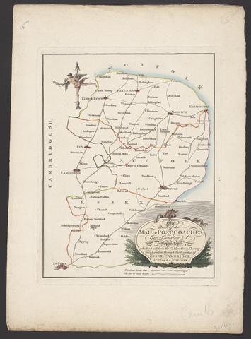
The route of the mail & post coaches, George Boulton & Co. proprietors
[between 1796 and 1809]
2
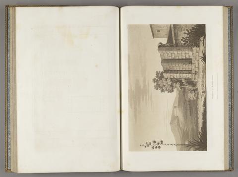
Wilkins, William, 1778–1839
The antiquities of Magna Graecia
MDCCCVII [1807]
3
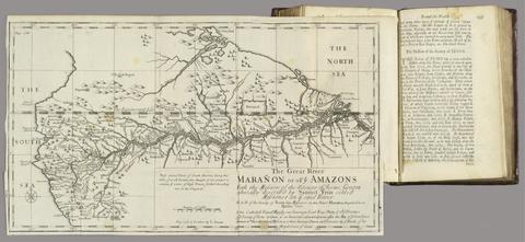
Cooke, Edward, Captain
A voyage to the South Sea, and round the world, perform'd in the years 1708, 1709, 1710, and 1711, by the ships Duke and Dutchess of Bristol
MDCCXII [1712]
4
Saxton, Christopher, 1542?-
[The travellers guide
[1686?]
5
Leslie, John, 1527–1596
Scotiae Regni Antiqvissimi Accvrata Descriptio
MDLXXVIII [1578]
6
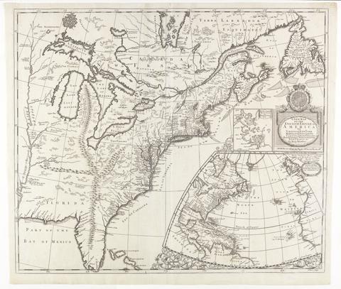
Morden, Robert, approximately 1650–1703
A new map of the English empire in America
[ca. 1695]
7
Wallis, J. (John), -1818
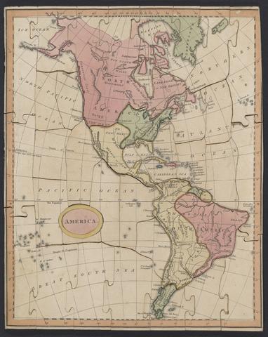
Wallis's new dissected map of America : engraved from the latest authorities, for the use of young students in geography
[between 1812 and 1818]
8
Visscher, Nicolaes, 1618–1679
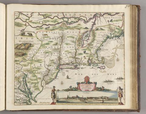
Novi Belgii Novaeque, Angliae nec non partis Virginiae tabula
[ca. 1684]
9
Clark, John Heaviside, approximately 1770–1863
Panorama of the Rhine and the adjacent country from Cologne to Mayence
[between 1834 and 1839]
10
Speed, John, 1552?-1629
America with those known parts in that unknowne worlde both people and manner of buildings
[1662?]
11
Walker's tour through England and Wales
January 2nd 1809
12
Great Britain. Ordnance Survey
[Old series Ordnance Survey maps of England and Wales]
[1839-1874?]
13
Keith, William, Sir, 1680–1749
The history of the British plantations in America
MDCCXXXVIII [1738]
14
C. & H. Greenwood
Map of the county of Monmouth
1831
15
Beattie, William, 1793–1875
Scotland
[approximately 1870?]
16
Morden, Robert, approximately 1650–1703
A new mapp of England Scotland and Ireland
[1678]
17
C. & J. Greenwood
Map of the county of Kent,
July 4th, 1829
18
Saxton, Christopher, 1542?-
Southamtoniae comitatus (preter insulas Vectis, Jersey et Garnsey quae sunt partes eius dem comitatus) cum suis undiq[ue] confinibus, oppidis, pagis, villis, et fluminibus vera descriptio
[1575]
19
Zeiller, Martin, 1589–1661
Topographia Archiepiscopatuvm Moguntinensis, Trevirensis, et Coloniensis
1646
20
Doornick, Marcus Williamsz
Platte grondt der Vebrande Stadt London
1666
21
Pittman, Philip, active 1760–1770
The present state of the European settlements on the Missisippi
MDCCLXX [1770]
22
Charlevoix, Pierre-François-Xavier de, 1682–1761
A voyage to North-America: undertaken by command of the present King of France
MDCCLXVI [1766]
23
Ortelius, Abraham, 1527–1598
Maris Pacifici (quod vulg ̣Mar del Zur)
1589
24
Burnaby, Andrew, 1732–1812
Travels through the middle settlements in North America, in the years 1759 and 1760
1798
25
Beechey, Frederick William, 1796–1856
Narrative of a voyage to the Pacific and Beering's strait
MDCCCXXXI [1831]
26
Froggett, John, active 1808–1821
Froggett's survey of the country thirty miles round London, 1836
[1836]
27
Cambridge Shire
[1695?]
28
Smyth, W. H. (William Henry), 1788–1865
Addenda to the Aedes Hartwellianae
MDCCCLXIV [1864]
29
Goos, Pieter, approximately 1616–1675
West-Indische paskaert
[approximately 1660]
30
Lyon, G. F. (George Francis), 1795–1832
A brief narrative of an unsuccessful attempt to reach Repulse Bay
MDCCCXXV [1825]
31
La Pérouse, Jean-François de Galaup, comte de, 1741–1788
Voyage de La Pérouse autour du monde
l'an VI de la République, 1798
32
Kruzenshtern, Ivan Fedorovich, 1770–1846
Voyage autour du monde, fait dans les années 1803, 1804, 1805 et 1806
1821
33
Valck, G. (Gerard), 1651–1726
Magna Britannia, aut Anglia, Scotia et Hibernia, quarum prior divisa in septem Regna, sive Provincias, dictas Northumbriam, Merciam, Angliam Orient. Essexiam, Cantium, Sussexiam, Westsexiam, et Princi. Walliae. posterior in Septent. et Austr. Scotiam. postrema in quatuor Provincias Ultoniam, Lageniam, Momoniam, et Conagtiam
[approximately 1705]
34
Evans, Lewis, 1700?-1756
A general map of the middle British colonies in America
1771
35
Anburey, Thomas, author
Travels through the interior parts of America
MDCCLXXXIX [1789]
36
Parker, Thomas Browne, 1797–1833
The journal and letters of the late Thomas Browne Parker, of Sweeney in the County of Salop, Esq.
1835
37
Cowley, J. (John)
A description of the windward passage, and Gulf of Florida, with the course of the British trading-ships to, and from the island of Jamaica
38
Adair, James, approximately 1709–1783
The history of the American Indians
MDCCLXXV [1775]
39
Stanford, Edward, 1827–1904
Stanford's library map of London and its suburbs
1862
40
Portlock, Nathaniel, 1748?-1817
A voyage round the world
MDCCLXXIX [1789]
41
Rocque, John, -1762
A map of the kingdom of Ireland
[between 1762 and 1773]
42
Perrot, A. M. (Aristide Michel), 1793–1879
Carte pittoresque et maritime de la France
1841
43
Parry, William Edward, Sir, 1790–1855
Journal of a voyage for the discovery of a north-west passage from the Atlantic to the Pacific
MDCCCXXI [1821]
44
Zeiller, Martin, 1589–1661
M.Z. Topographia Bohemiæ, Moraviæ et Silesiæ
1650
45
Matthews, John, lieutenant in the Royal Navy
Twenty-one plans, with explanations of different actions in the West Indies, during the late war
MDCCLXXXIV [1784]
46
Atkinson, Christopher W. (Christopher William)
The emigrant's guide to New Brunswick, British North America
1842
47
Rapkin, J
England and Wales
[1851?]
48
Green, James, 1771–1834
Picturesque geography
[1817?]
49
C. & J. Greenwood
Map of the county palatine of Durham,
Jan. 26, 1831
50
Exquemelin, A. O. (Alexandre Olivier)
The history of the bucaniers of America
1704
51
Mackenzie, Alexander, 1764–1820
Voyages from Montreal, on the river St. Laurence, through the continent of North America, to the frozen and Pacific oceans ; in the years 1789 and 1793
MDCCCI [1801]
52
Zeiller, Martin, 1589–1661
Topographia Bavariæ, das ist, Beschreib. vnd aigentliche Abbildung der vornembsten Stätt vnd Orth in Ober vnd Nieder Beÿern, der obern Pfaltz, vnd andern, zum hochlöblichen Baÿrischen Craisse gehörigen Landschaften
MDCXLIV [1644]
53
A practical guide during a journey from London to Paris
1802
54
Freycinet, Louis Claude Desaulses de, 1779–1842
Voyage autour du monde
1824-1844
55
Evans, Lewis, 1700?-1756
A map of Pensilvania, New-Jersey, New-York, and the three Delaware counties
1749
56
Morden, Robert, approximately 1650–1703
England
[1695?]
57
Senex, John, -1740
A new map of the English empire in America
1719
58
Morant, Philip, 1700–1770
The history and antiquities of the county of Essex
1768
59
Artis, Edmund Tyrell, 1789–1847
The Durobrivae of Antoninus
1828
60
Karl Baedeker (Firm)
London and its environs
1878
61
Valck, G. (Gerard), 1651–1726
Les isles Britanniques, qui contiennent les Royaumes d'Angleterre, Escosse, et Irlande
[approximately 1695]
62
Broughton, William Robert, 1762–1821
A voyage of discovery to the North Pacific Ocean
1804
63
Lyon, G. F. (George Francis), 1795–1832
The private journal of Captain G.F. Lyon, of H.M.S. Hecla, during the recent voyage of discovery under Captain Parry
1824
64
Journal dédié a Monsieur frere du roi
65
Peacock, W. (William), -1910
Scotland
[between 1901 and 1909?]
66
La Rochefoucauld-Liancourt, François-Alexandre-Frédéric, duc de, 1747–1827
Travels through the United States of North America
1799
67
Cary, John, approximately 1754–1835
A new map of Leicestershire
Sepr. 28,1801
68
Beresford, William, active 1788
A voyage round the world
1789
69
Dury, Andrew
A topographical map of Hartford-shire, from an actual survey
[1782]
70
Zeiller, Martin, 1589–1661
Topographia Franconiæ
[1648?]
71
Stedman, C. (Charles), 1753–1812
The history of the origin, progress, and termination of the American war
1794
72
Colden, Cadwallader D. (Cadwallader David), 1769–1834
Memoir
1825
73
Zeiller, Martin, 1589–1661
Topographia Palatinatus Rheni et vicinarum regionum
1645
74
Carrington, F. A. (Frederick Augustus), 1801–1860
A map of Scotland
1856
75
Cassini, César-François, 1714–1784
A map of the kingdom of France
Augt. 2nd. 1838
76
Heriot, George, 1759–1839
Travels through the Canadas, containing a description of the picturesque scenery on some of the rivers and lakes
[1807]
77
Franklin, John, 1786–1847
Journey to the shores of the Polar Sea, in the years 1819-20-21-22
MDCCCXXIX [1829]
78
Forbes, Alexander, 1778–1862
California
1839
79
Alexander, James Edward, Sir, 1803–1885
Transatlantic sketches
1833
80
Andrews, John, 1736–1809
A topographical map of Wiltshire
[1773]
81
Clúny, Alexander
The American traveller, or, Observations on the present state, culture and commerce of the British colonies in America, and the further improvements of which they are capable
MDCCLXIX [1769]
82
Moule, Thomas, 1784–1851
Cambridge
[1830?]
83
Dampier, William, 1652–1715
A collection of voyages
MDCCXXIX [1729]
84
Rapkin, J.
The illustrated atlas and modern history of the world
[1851?]
85
Bowen, Emanuel, -1767
The County of Cambridge
1759
86
James, Edwin, 1797–1861
Account of an expedition from Pittsburgh to the Rocky Mountains
1822-1823
87
Morden, Robert, approximately 1650–1703
Westmorland
[1695]
88
Blaeu, Willem Janszoon, 1571–1638
America quarta pars orbis ..
[1686?]
89
Burney, James, 1750–1821
A chronological history of the discoveries in the South Sea or Pacific Ocean
1803-1817
90
Bonnycastle, Richard Henry, Sir, 1791–1847
Newfoundland in 1842
1842
91
A map of Cambridgeshire
[1720?]
92
Popple, Henry, -1743
A map of the British Empire in America, with the French and Spanish settlements adjacent thereto
[1739]
93
Bell, James, 1769–1833
A new and comprehensive gazetteer of England and Wales
MDCCCXXXIII-MDCCCXXXIV [1833-1834]
94
Browne, Christopher, active 1684–1712
A new map of Virginia, Maryland, and the improved parts of Pennsylvania & New Jersey
[1685?]
95
Dallaway, James, 1763–1834
A history of the western division of the county of Sussex
1815-1832
96
Morden, Robert, approximately 1650–1703
To Captain John Wood this map of the world drawn according to Mercators projection humbly dedicated by Robt. Morden & Willm. Berry
[approximately 1682?]
97
Ginot des Rois, Mlle
Jeu des petits voyageurs aux cinq parties du monde, ou, Enseignement mutuel de géographie descriptive et historique
1828
98
Kitchin, Thomas, 1719–1784
A new improved map of Oxfordshire
[1750]
99
Ellis, Henry, 1721–1806
A voyage to Hudson's-Bay
MDCCXLVII [1748]
100
Mitchell, John, 1711–1768
A map of the British and French dominions in North America