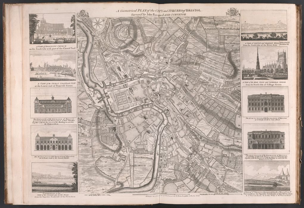
A geometrical plan of the city and suburbs of Bristol / survey'd by John Rocque ...
Published / Created:
[Bristol] : B. Hickey, bookseller in Nicolas Street, [175-?]
Physical Description:
1 map : ill. ; 48 x 45 cm., on sheet 55 x 75 cm.
Holdings:
Rare Books and ManuscriptsFolio A G 14
Copyright Status:
Public Domain
Related Content:
View a selection of digital images in the Yale Center for British Art's online catalogue
https://collections.britishart.yale.edu/catalog/orbis:584372
Classification:
Maps & Atlas (printed)
Scale:
Scale [ca. 1:20,200].
Notes:
BAC: British Art Center copy bound with: Plan de la ville et foubourgs [sic] de York / Peter Chassereau. [London] : J. Rocque, 1750. This vol. supposedly belonged to John Rocque.Relief shown by hachures.Includes 10 views of the public buildings of Bristol.Except for title, imprint & some additions to the illustration captions, this map appears to be identical to Rocque's 1750 map with title: A survey of the city and suburbs of Bristol.
Subject Terms:
Rocque, John, -1762 -- Provenance. | Hickey, B. -- Publisher. | Bristol (England) -- Maps. | Bristol (England) -- Pictorial works. | Bristol Region (England) -- Maps -- Early works to 1800.