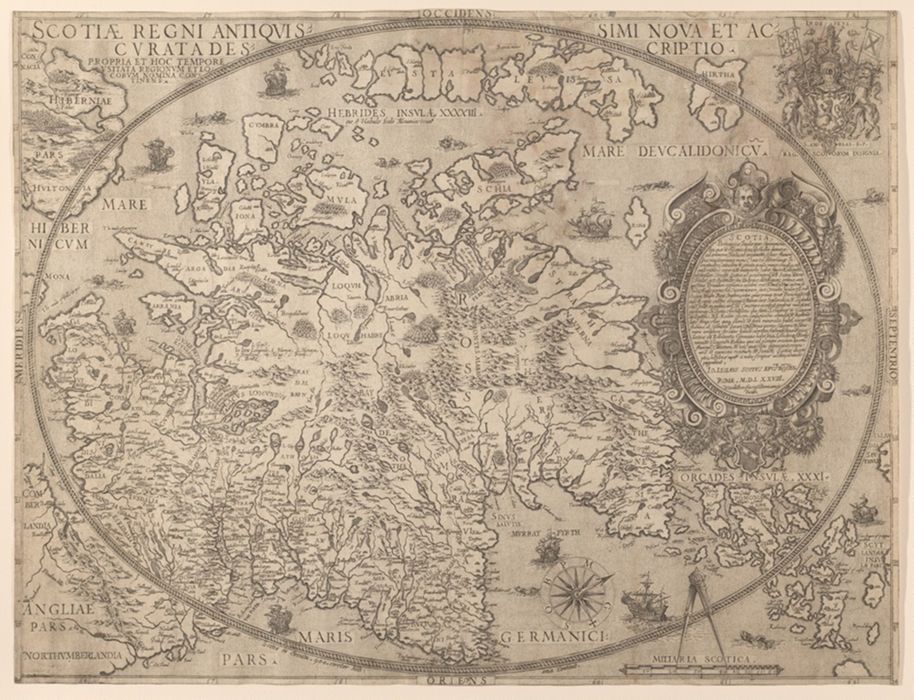
Scotiae Regni Antiqvissimi Accvrata Descriptio / Io Leslavs, Epus Rossen.
Alternate Title(s):
Scotiae Regni Antiquissimi Accurata Descriptio
Published / Created:
Romae : Natalis Bonifacius, MDLXXVIII [1578]
Physical Description:
1 map : engraving ; 40.5 x 53.5 cm, on sheet, 41.5 x 54.5 cm
Holdings:
Rare Books and ManuscriptsFolio C 2010 1hYale Center for British Art, Paul Mellon Collection
Copyright Status:
Public Domain
Related Content:
View a selection of digital images in the Yale Center for British Art's online catalogue
https://collections.britishart.yale.edu/vufind/Record/2030109
Classification:
Maps & Atlas (printed)
Scale:
Scale not given.
Notes:
Relief shown pictorially.Features include ships and sea monsters.Ornate cartouche with crests.Orientated with north to the right.Skelton, R.A. "Bishop Leslie's Maps of Scotland, 1578." In: Imago Mundi, VII (1950) p. 103-106BAC: British Art Center copy uncolored.Selected exhibitions: "The Mapmaker's art : 300 years of British cartography" (Yale Center for British Art, January 17-March 12, 1989).The first separately printed map of Scotland. Leslie based his map on one published in a 1573 atlas produced by Abraham Ortelius, but altered many of the place names and corrected the shape of some of the Western Isles.
Exhibition History:
The Mapmaker's Art: 300 Years of British Cartography (Yale Center for British Art, January 17, 1989-March 12, 1989)
Subject Terms:
Scotland -- Maps -- Early works to 1800. | Scotland.