YCBA Collections Search
Refine your search
- Bunbury, Henry William, 1750–18113
- London, Transport, 1937–20043
- Borra, Giovanni Battista, 1713–17702
- Dawson, Robert Kearsley, 1798–18612
- Lewis, Benjamin Getzel, 1900–19662
- Page, P. D. H. Mrs., 20th century2
- Russell, John, 1745–18062
- Unknown artist2
- Waterlow and Sons2
- White, John, active 1585–15932
- Baker, Benjamin, 1766–18411
- Baynard Press1
- Blaeu, Willem Janszoon, 1571–16381
- Breda, Carl Frederick van, 1759–18181
- Bretherton, James, ca. 1730–18061
- Brett, Simon, born 19431
- Brown, John, 1749–17871
- Chapman, John, active ca. 1792–18231
- Cleghorn, John, active 1840–18811
- Constable, John, 1776–18371
- more Creator »
Current results range from 1634 to 2006
Current results range from 11 to 132
- Unknown 1
Current results range from 9 to 154
- Unknown 1
- Uncle Toby3
- Obadiah2
- Amherst, Jeffrey, first Baron Amherst (1717–1797), army officer1
- Carl Bernhard Wadström (1746–1799), abolitionist1
- Cordelia (character in King Lear)1
- Corporal Trim1
- Doctor Slop1
- Foote, Samuel (bap. 1721, d. 1777), actor and playwright1
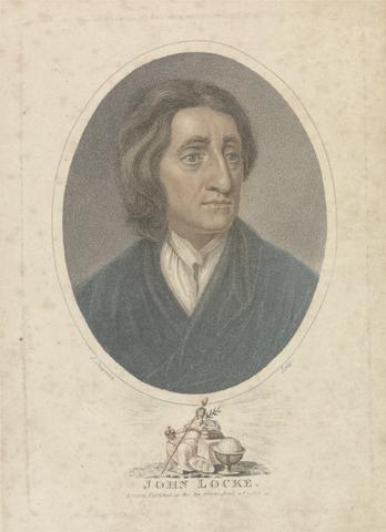
- Locke, John (1632–1704), philosopher1
- Panah, Peter, son of the king of Cape Mesurado (in present-day Liberia)1
- Russell, Samuel Thomas (1766–1845), actor1
- Shakespeare, William (1564–1616), playwright and poet1
- Sheikh Hussein of Gebel1
- Stewart, Frederick William Robert, Viscount Castlereagh, later fourth Marquess of Londonderry (1805–1872)1
- Trim (from Tristram Shandy)1
- Tristam Shandy1
- An American's Passion for British Art - Paul Mellon's Legacy (Royal Academy of Arts, 2007-10-20 - 2008-01-27)2
- An American's Passion for British Art - Paul Mellon's Legacy (Yale Center for British Art, 2007-04-18 - 2007-07-29)2
- Paul Mellon's Legacy : A Passion for British Art (Yale Center for British Art, 2007-04-18 - 2007-07-29)2
- Wilde Americk - Discovery and Exploration of the New World, 1500-1850 (Yale Center for British Art, 2001-09-27 - 2001-09-27)2
- Apollo's Muse: The Moon in the Age of Photography (The Metropolitan Museum of Art, 2019-07-01 - 2019-09-22)1
- Art in Focus : The British Castle - A Symbol in Stone (Yale Center for British Art, 2017-04-07 - 2017-08-06)1
- Connections (Yale Center for British Art, 2011-05-26 - 2011-09-11)1
- Dare to Know: Prints and Drawings in the Age of Enlightenment (Harvard Art Museums, 2022-09-15 - 2023-01-16)1
- Edward Lear and the Art of Travel (Yale Center for British Art, 2000-09-20 - 2001-01-14)1
- Figures of Empire: Slavery and Portraiture in Eighteenth-Century Atlantic Britain (Yale Center for British Art, 2014-10-02 - 2014-12-14)1
- Figuring Women - The Female in Modern British Art (Yale Center for British Art, 2008-03-28 - 2008-06-08)1
- Grecian Taste and Roman Spirit: The Society of Dilettanti (The J. Paul Getty Museum, 2008-08-07 - 2008-10-27)1
- Lure of the East - British Orientalist Painting (Tate Britain, 2008-06-04 - 2008-08-31)1
- Photographs | Contemporary Art: Recent Gifts and Acquisitions (Yale Center for British Art, 2019-06-20 - 2019-09-08)1
- Ruskin - Past: Present: Future (Yale Center for British Art, 2000-01-20 - 2000-02-27)1
- Shakespeare and British Art (Yale Center for British Art, 1981-04-23 - 1981-07-05)1
- The Black Figure in the European Imaginary (Cornell Fine Arts Museum, 2017-01-20 - 2017-05-15)1
- The City of Sardis : Approaches in Graphic Recording (Harvard Art Museums, 2003-08-23 - 2003-11-30)1
- The Critique of Reason : Romantic Art, 1760–1860 (Yale University Art Gallery, 2015-03-06 - 2015-07-26)1
- The Fuseli Circle in Rome - Early Romantic Art in the 1770s (Yale Center for British Art, 1979-09-12 - 1979-11-11)1
- more Exhibition History »
- Yale Center for British Art, Paul Mellon Collection22
- Yale Center for British Art, Paul Mellon Fund5
- Yale Center for British Art, Gift of Henry S. Hacker, Yale BA 19653
- Yale Center for British Art, Gift of Brian and Celia Hopkinson1
- Yale Center for British Art, Gift of Driek and Michael Zirinsky in honor of Christine Higgott and Peter Ford1
- Yale Center for British Art, Gift of Helen Chillman1



![Mrs. P. D. H. Page Map of North America from Florida to Chesapeake Bay, after the original by John White in the British Museum [Sir Walter Raleigh's Virginia, No. 110]](https://media.collections.yale.edu/thumbnail/ycba/f14d2599-644f-40b2-8aee-01feeb08ac1a)
![Mrs. P. D. H. Page Map of Raleigh's Virginia: The East Coast of North America from Cape Lookout to Chesapeake Bay, after original by John White in the British Museum [Sir Walter Raleigh's Virginia, No. 111 A]](https://media.collections.yale.edu/thumbnail/ycba/aa273bf1-4d54-4726-99f1-aa8836010023)
