Search Constraints
You searched for:
Language English
Remove constraint Language: EnglishWork Type map
Remove constraint Work Type: mapSearch Results

1
- A plan of mathematical learning taught in the Royal Academy, Portsmouth
- approximately 1798-1799

2
- Cambridgeshire
- [1808]

3
- London before the fire in 1666 = Plan de Londres tel quil etoi avant l'incendie de 1666
- [1666?]

4
- A survey of the estate of Richard Moore, Esq., Kentwell Hall, Suffolk
- 1777

5
- Africa
- MDC LXX [1670]

6
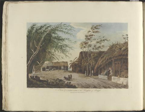
- A survey and valuation of estates the property of Nicholas Smyth Esqr. and his Lady
- 1767

7
- Panorama of the Rhine and the adjacent country from Cologne to Mayence
- [between 1834 and 1839]

8
- Crowned heads, or, Contemporary sovereigns
- [ca. 1845?]

9
- Queen Hotel
- [188-?]

10
- America
- MDCLXXI [1671]

11
- The antiquities of Magna Graecia
- MDCCCVII [1807]

12
- Academiarum totius Europae seu orbis Christiani iuxta suas provincias nova tabula ad usum studiosorum emendate accomodate
- An 1602

13
- The map of England and Wales with part of Scotland, France and Ireland, worked by Maria Harvey in the ninth year of age
- 1806

14
- Festival pleasure gardens
- 1951

15
- Map of North America
- not before 1634

16
- Bartholomew's one inch to the mile environs of London
- [not before 1921]

17
- A map of the Zoological Society Gardens in Regents Park commonly called The Zoo
- [approximately 1947]

18
- London and Westminster in the reign of Queen Elizabeth anno dom. 1563
- October 30th, 1789

19
- Sir Joseph Banks's fishery book of the River Witham in Lincolnshire
- 1784-1800

20
- The route of the mail & post coaches, George Boulton & Co. proprietors
- [between 1796 and 1809]
21
- Choix de vues de l'Inde
- [1788]

22
- A survey of the estate of John Plampin Esquire, taken in 1774,
- 1774

23
- London and Westminster improved
- MDCCLXVU [1766]

24
- L'orient, or, The Indian travellers : a geographical and historical game
- [1846]

25
- The famouse West Indian voyadge made by the Englishe fleete of 23 shippes and barkes
- [1589?]

26
- Outline of the countries between Delhi and Constantinople
- 1814 [i.e. 1821?]

27
- Map of the southeastern part of North America
- 1721

28
- Survey and valuation of the several estates belonging to John Kinchant Esqr. and Emma his wife
- 1765

29
- A large and accurate map of the city of London
- 1677]

30
- A map of London and the adjacent country 10 miles round
- 1748

31
- Britain at home to the world
- 1951

32
- The county of Dorset
- June 1st, 1795

33
- Survey of Hertford Castle
- 1608

34
- The environs of London
- [1763]

35
- Bugle Hotel, Newport, Isle of Wight
- [late 19th century]

36
- Wallis's new dissected map of America : engraved from the latest authorities, for the use of young students in geography
- [between 1812 and 1818]

37
- Summer of smiles
- 2011

38
- Wallis's tour of Europe
- Nov. 24th, 1794

39
- Plans for the fortifications at Hull
- 1681-1682

40
- The bounds of the fortificatie of Gosport
- approximately 1678

41
- The Fort Devereux placed uppon the Ferne Islande
- circa 1600

42
- Marchionatus Brandenburgicus
- [ca. 1681]

43
- Plan of the town of Hull and its immediate surroundings
- ca. 1680

44
- To Martin Folkes, esq., president of the Royal Society
- 1749

45
- A voyage to the South Sea, and round the world, perform'd in the years 1708, 1709, 1710, and 1711, by the ships Duke and Dutchess of Bristol
- MDCCXII [1712]

46
- A map of Hindoostan or the Mogul Empire
- 1788

47
- [The travellers guide
- [1686?]

48
- Kyngeston vpon Hvll
- circa 1642

49
- James Forbes archive

50
- The Crystal Palace game
- [1854?]

51
- This newly constructed and extended map of India
- 1841

52
- North America, and the West Indies
- [1764?]

53
- A new map of the English empire in America
- [ca. 1695]

54
- A plan of Rome
- 1750

55
- The paths of life
- [circa 1840]

56
- Illustrated excursions in Italy
- MDCCCXLVI [1846]
57
- Northumberland and Durham
- [between 1888 and 1898]
58
- Survey of the country around London
- 1852
59
- A geological map of England & Wales
- November 1st, 1819 [that is, 1820]
60
- France (north west), Belgium (west and central), Holland (part of) ; France (south west), Spain (north)
- [1943?]
61
- Plan of fortification, possibly at Newtown, Isle of Wight
- December, 1671
62
- Memoir
- 1825
63
- North & central Italy and the island of Corsica
- [1863?]
64
- James Bruce archive,
- ca. 1750-ca.1850
65
- The roads from London to Norwich, Cambridge, Ely & Kings Lynn
- [1775?]
66
- A map of the British Empire in America
- [ca. 1737]
67
- The American gazetteer
- 1762
68
- A voyage round the world
- MDCCLXXIX [1789]
69
- New and Improved map of England and Wales, including the principal part of Scotland
- 16th. April 1823
70
- [Old series Ordnance Survey maps of England and Wales]
- [1839-1874?]
71
- The Seraglio & gardens of the Grand Seignior = Serrail & jardins du Grand Seigneur
- 1752
72
- Black's travelling map of Ireland
- [184-?]
73
- Map of the Province of Malabar by A. Arrowsmith
- 1809
74
- A new map of Leicestershire
- Sepr. 28,1801
75
- Cambridgeshire
- [1837]
76
- Plan of Carisbrooke Castle, Isle of Wight
- [1671?]
77
- A voyage round the world
- 1789
78
- Plans of the fortifications at Newport and Cowes, Isle of Wight
- [1671?]
79
- [Norwich]
- January 1st 1838
80
- Whitbread's new plan of London
- 1851
81
- Public works of Great Britain
- 1838
82
- Map of the island of Ceylon
- 5, Janry. 1805
83
- A history of the campaigns of 1780 and 1781 in the southern provinces of North America
- MDCCLXXXVII [1787]
84
- A new map of Virginia, Maryland, and the improved parts of Pennsylvania & New Jersey
- [1685?]
85
- Smith's new plan of London, Westminster & Southwark
- Jany. 1st. 1803
86
- The popular post card wallet guide to London
- 1925?]
87
- To Mark Wood Esq., M.P. colonel of the Army in India, late Chief Engineer and Surveyor General, Bengal, this map of India, compiled from various interesting and valuable materials, is inscribed in grateful testimony of his liberal communications
- 1804
88
- Bus map central area
- 1972
89
- The city of London, in the time of the Saxons (about the year 1000)
- April 25th, 1817
90
- London and its environs
- 1878
91
- W.H. Smith & Son's war map of Afghanistan
- 1878
92
- Jackson's map of the Bedale Hunt
- [ca. 1896]
93
- Bacon's large scale plan of Barking
- [1913]
94
- The Coronation of Their Majesties King George VI & Queen Elizabeth
- [1937]
95
- S. Stockwell underground map
- [2012]
96
- The "District Railway" miniature map of London
- [ca. 1887?]
97
- A new map of metropolitan railways, tramways & miscellaneous improvements
- January 1st, 1874
98
- Sketches of Bermuda, or Somers' islands
- 1828
99
- A plan for rebuilding the city of London, after the great fire in 1666
- [1749 October 3]
100
- A plan of London on the same scale as that of Paris
- 1754