Search Constraints
You searched for:
Associated Places Great Britain
Remove constraint Associated Places: Great BritainSubject Terms British Isles -- Maps -- Early works to 1800.
Remove constraint Subject Terms: British Isles -- Maps -- Early works to 1800.Search Results

- Date:
- MDLVI [1556]
- Physical Description:
- 1 map ; 47.9 x 34.5 cm, on sheet 53.3 x 40.0 cm.
- Collection:
- Rare Books and Manuscripts

- Date:
- [1678]
- Physical Description:
- 1 map : engraving ; 50 x 57 cm, on sheet 54 x 63 cm
- Collection:
- Rare Books and Manuscripts

- Date:
- [approximately 1705]
- Physical Description:
- 1 map : engraving, hand-colored ; 46 x 58 cm, on sheet 54 x 65 cm
- Collection:
- Rare Books and Manuscripts

- Date:
- [approximately 1695]
- Physical Description:
- 1 map : engraving, hand colored ; 46 x 56 cm, on sheet 51 x 61 cm
- Collection:
- Rare Books and Manuscripts

- Date:
- MDLVIII [1558]
- Physical Description:
- 1 map ; 38.2 x 52.3 cm, on sheet 42.8 x 55.6 cm.
- Collection:
- Rare Books and Manuscripts

- Date:
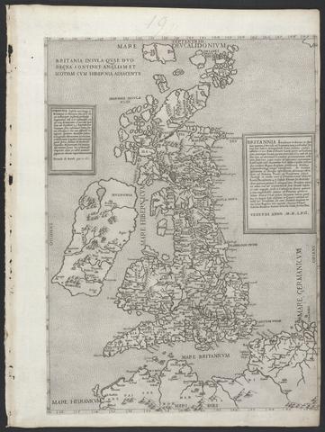
- anno MDLXII [1562]
- Physical Description:
- 1 map ; 47.0 x 34.2 cm, on sheet 53.2 x 40.0 cm.
- Collection:
- Rare Books and Manuscripts

- Date:
- MDXLVI [1546]
- Physical Description:
- 1 map on 2 sheets ; 51.8 x 72.2 cm, on sheet 56.2 x 76.3 cm.
- Collection:
- Rare Books and Manuscripts