Search Constraints
You searched for:
Date 1680
Remove constraint Date: 1680Image Use Under Certain Circumstances
Remove constraint Image Use: Under Certain CircumstancesSearch Results
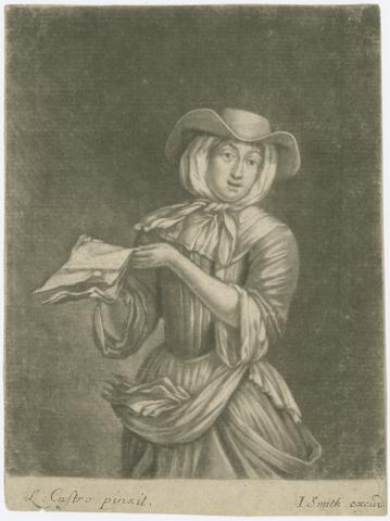
1
- [ A Ballad singer
- [1680?]
![[Panorama of popular printed images].](https://media.collections.yale.edu/thumbnail/ycba/3bbae80e-8885-4726-bc2f-3688e8dd6b3b)
2
- [Panorama of popular printed images]
- [circa 1680]

3
- Plan of the town of Hull and its immediate surroundings
- ca. 1680

4
- Recueil des meilleurs desseins de Raimond La Fage gravé par cinq des plus habiles graveurs
- [168-]
5
- Les tables de geographie, reduites en un jeu de cartes
- [ca. 1680?]
6
- The compleat gamester: or, Instructions how to play at billiards, trucks, bowls, and chess
- 1680
7
- Sculpturae veteris admiranda, sive, Delineatio vera perfectissimarum eminentissimarumque statuarum
- anno MDCLXXX [1680]
8
- Iconologia deorum, oder, Abbildung der Götter
- anno MDCLXXX [1680]
9
- Nautical chart of Grand Havre, Guernsey
- ca. 1680
10
- The English atlas ...
- MDCLXXX-MDCLXXXIII [1680-1683]
11
- Plan of Scarbrogh Castle & towne
- circa 1680
12
- Europa
- [ca. 1686?]
13
- Asia
- [ca. 1686?]